
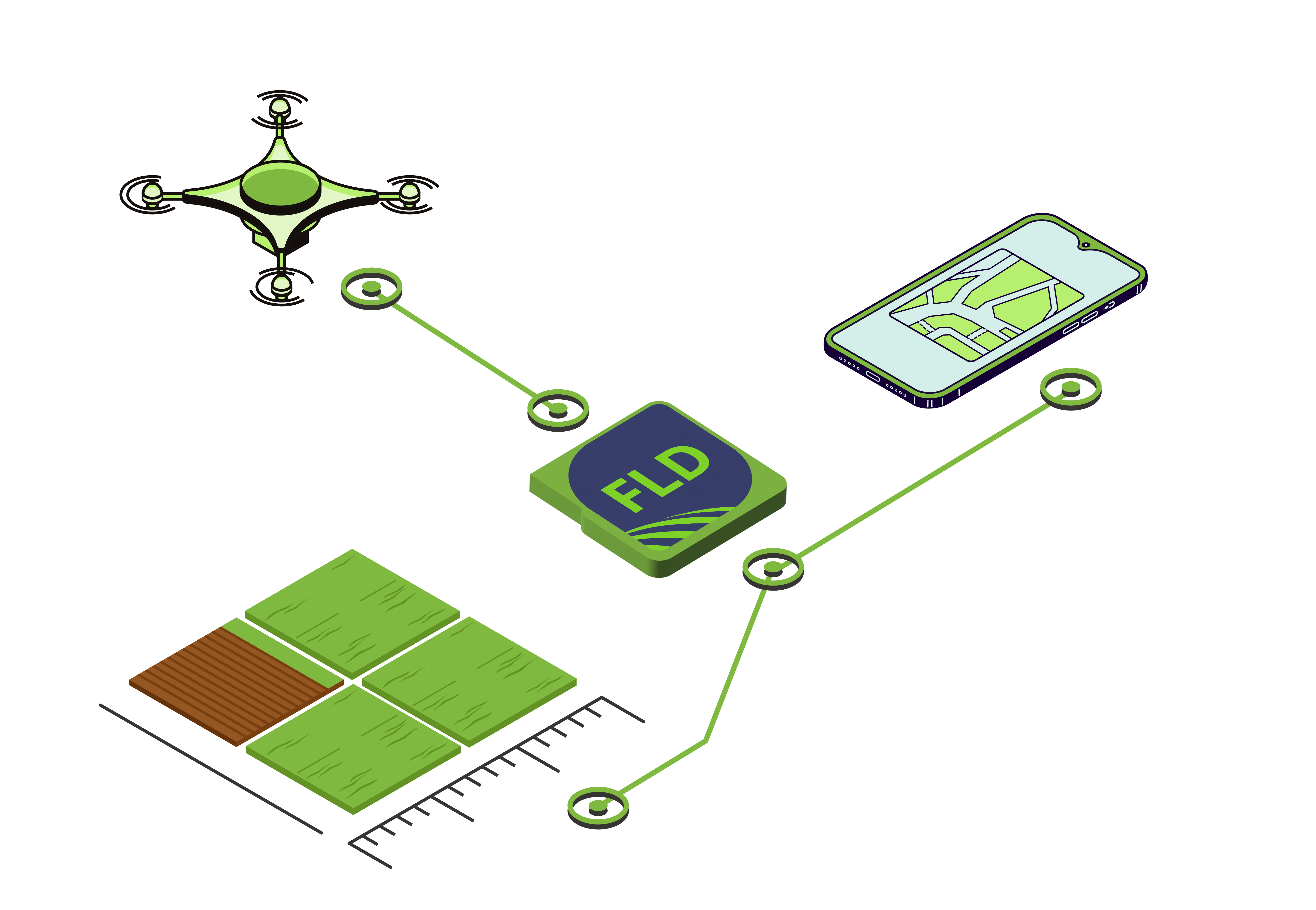
AP Fields
mobile application for accurate field area measurement
Abstract of the functionality
Why choose AP Fields?
⦿ High measurement accuracy with Trimble antennas and GPS
⦿ User-friendly interface and easy report creation
⦿ Manual polygon editing capability
⦿ Visualization and management of all fields and shares
⦿ Synchronization with ERP: up-to-date data in real time
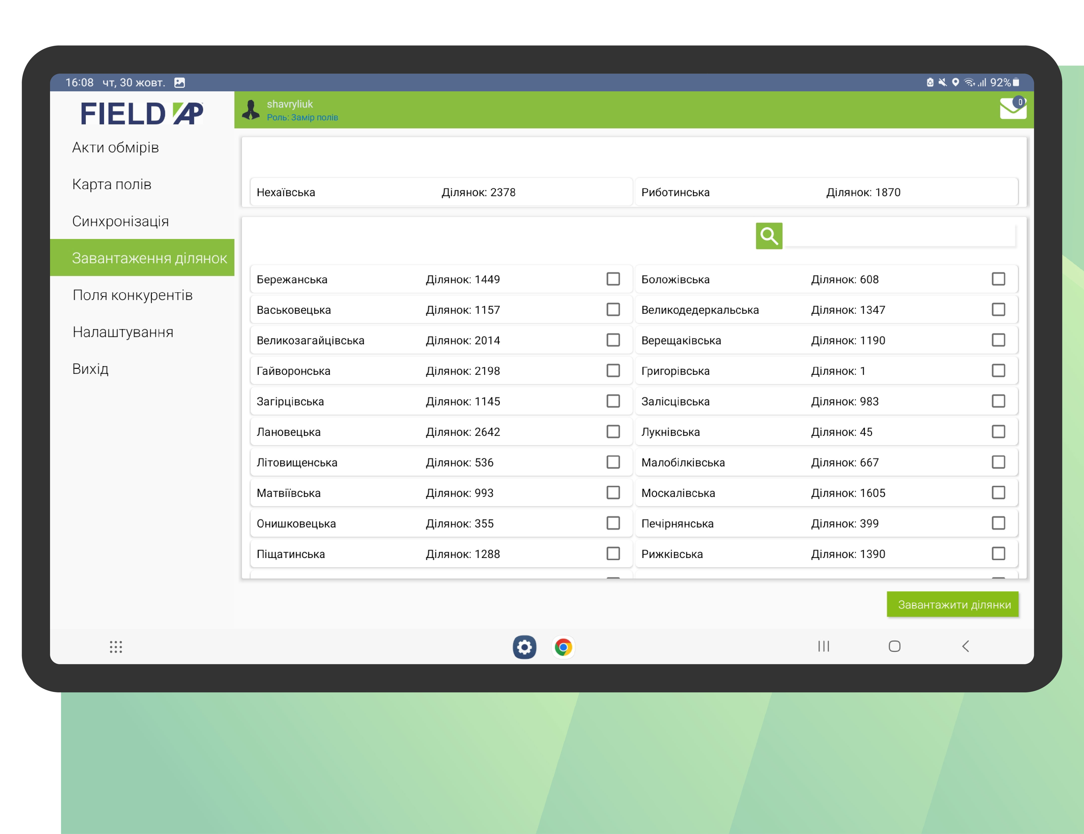
⦿ Downloading competitor data for comparison
⦿ Ability to account for even complex field configurations
⦿ Support for mobile work — measurements directly in the field
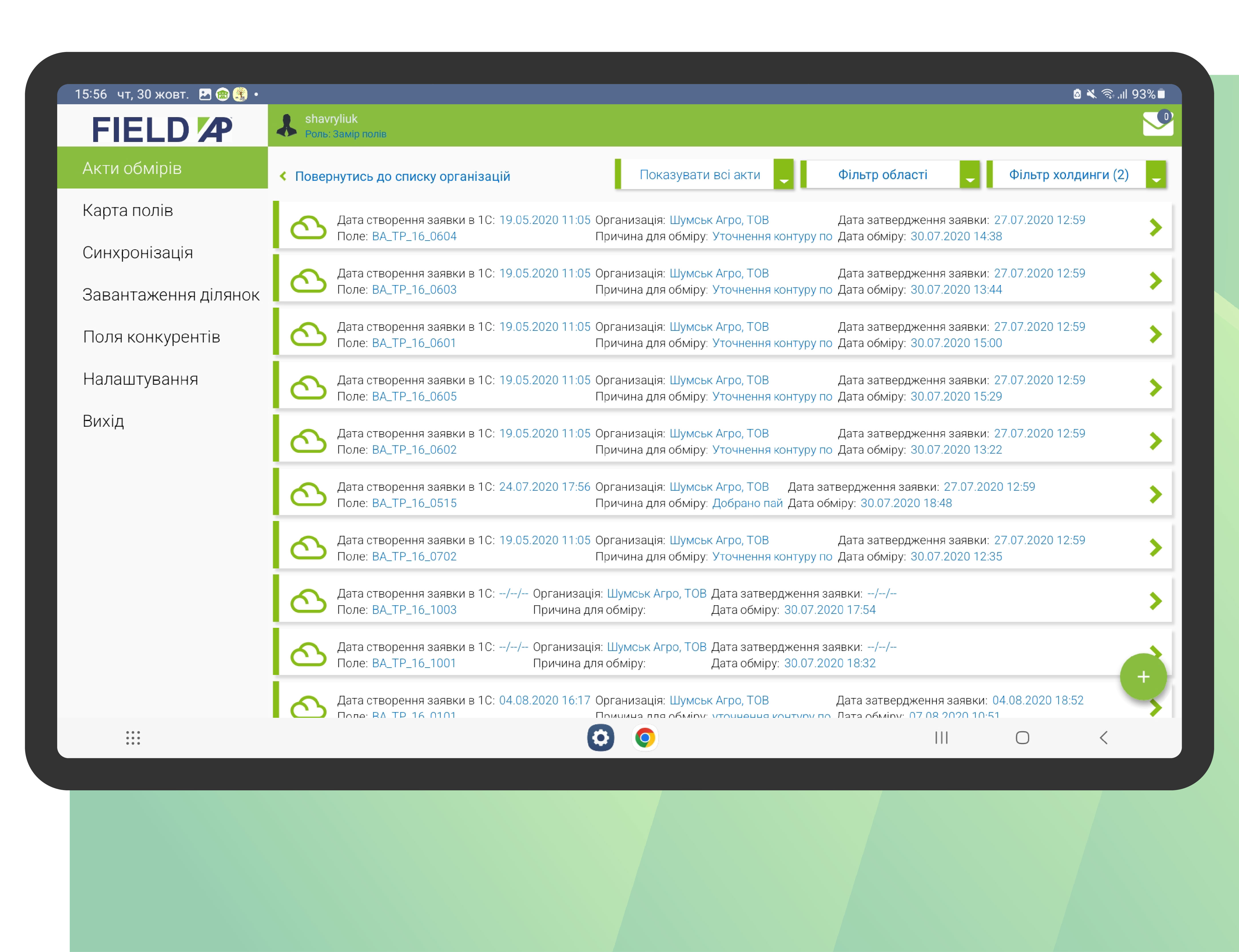
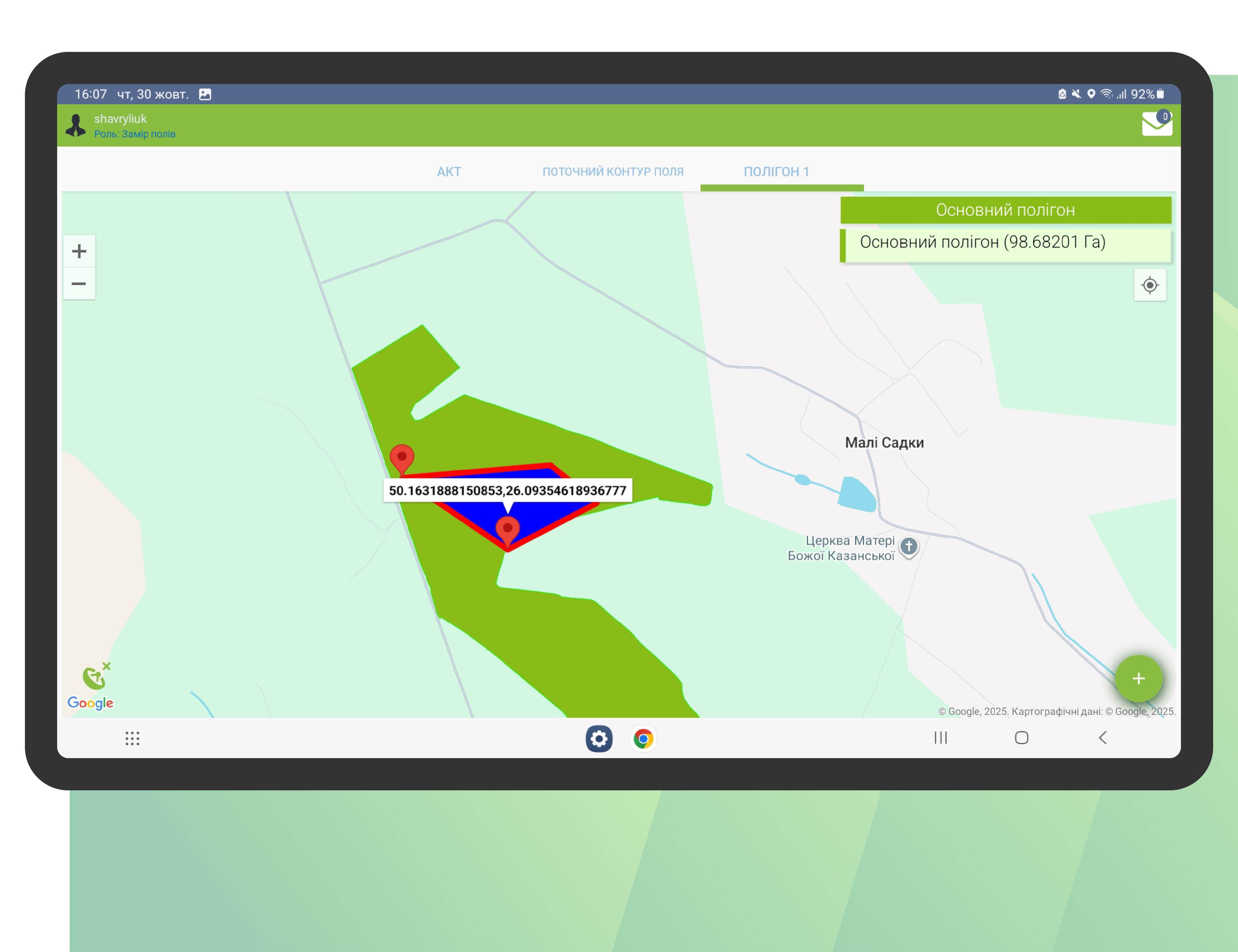
Creation of a measurement report
The process of creating an act, pulling up the polygon, association with ERP
Measurement using GPS
Pressing the “Start measurement” button, driving around the territory, completion
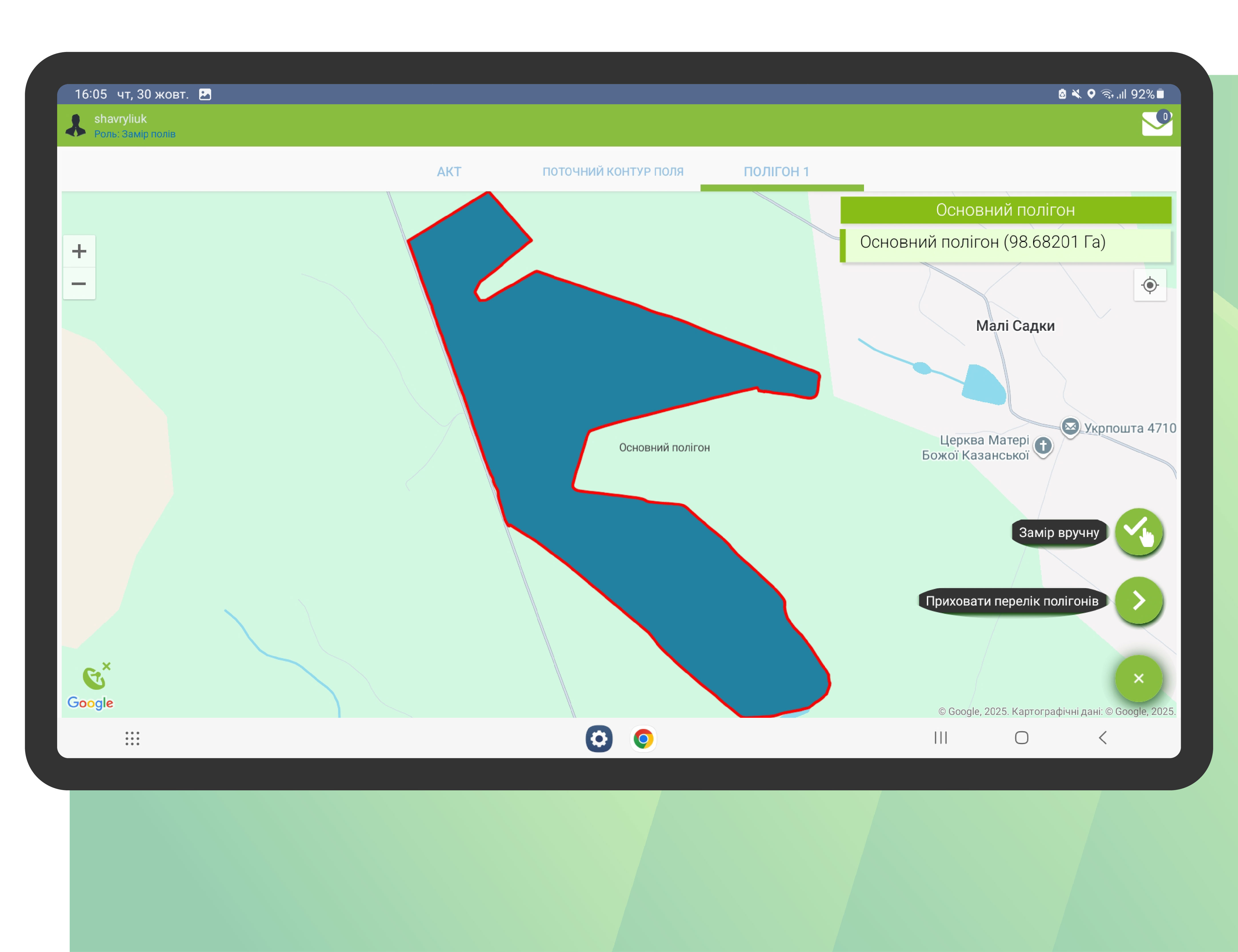
Manual measurement
Moving a vertex, adding a new one, cutting out part of the field
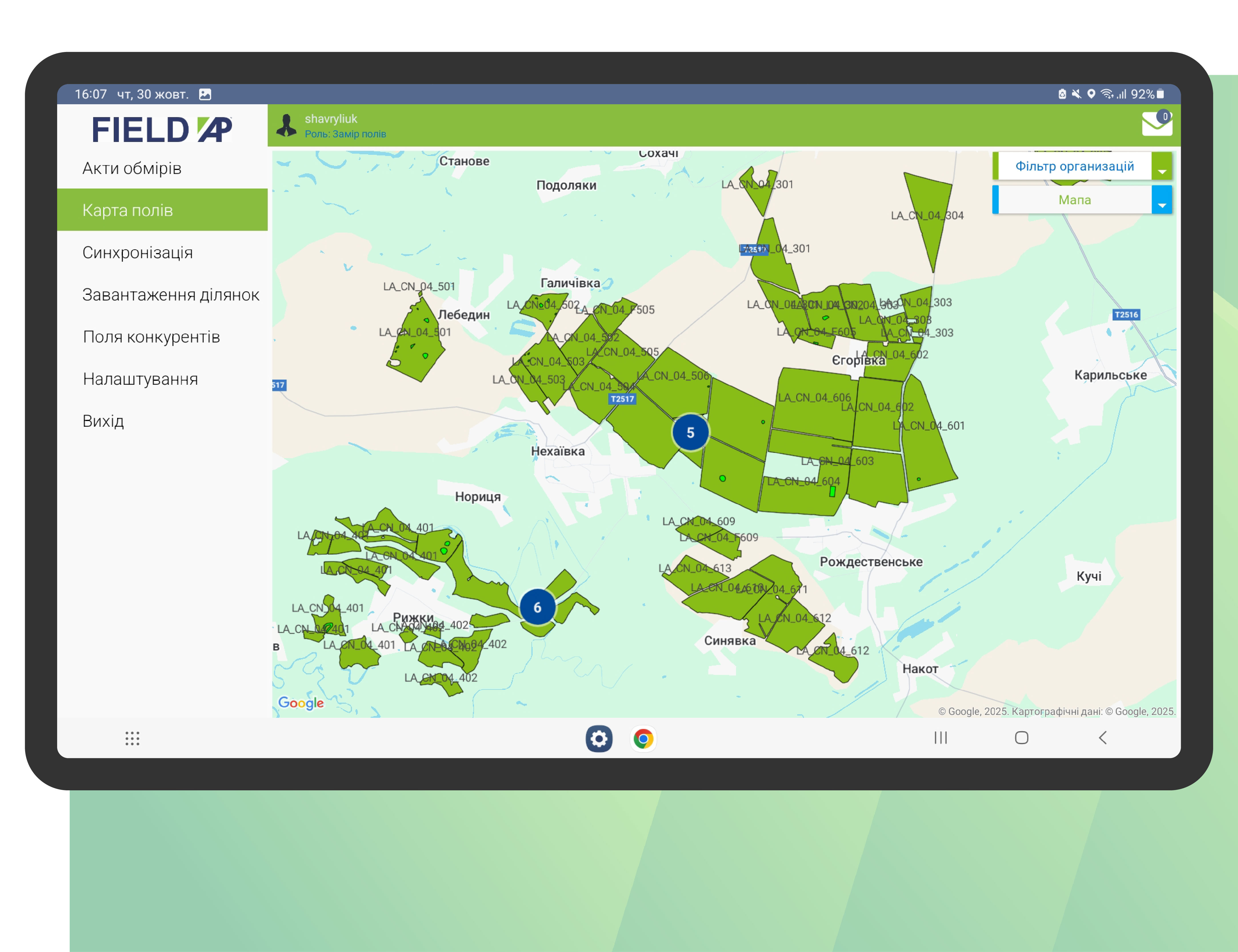
Map of fields and land shares
Visualization of shares on the map, information on each one
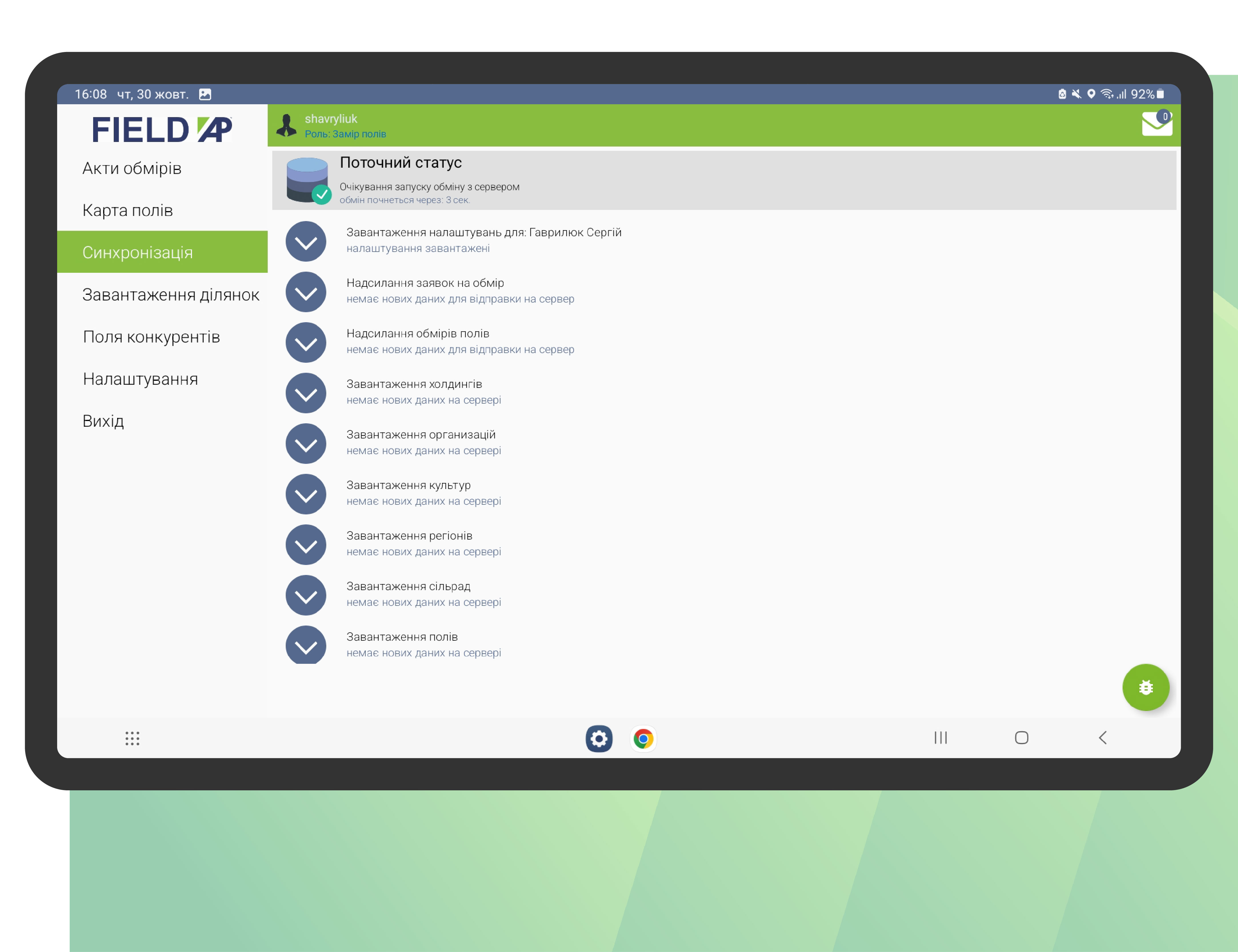
Synchronization with ERP
Pulling up sections, measurement approval statuses
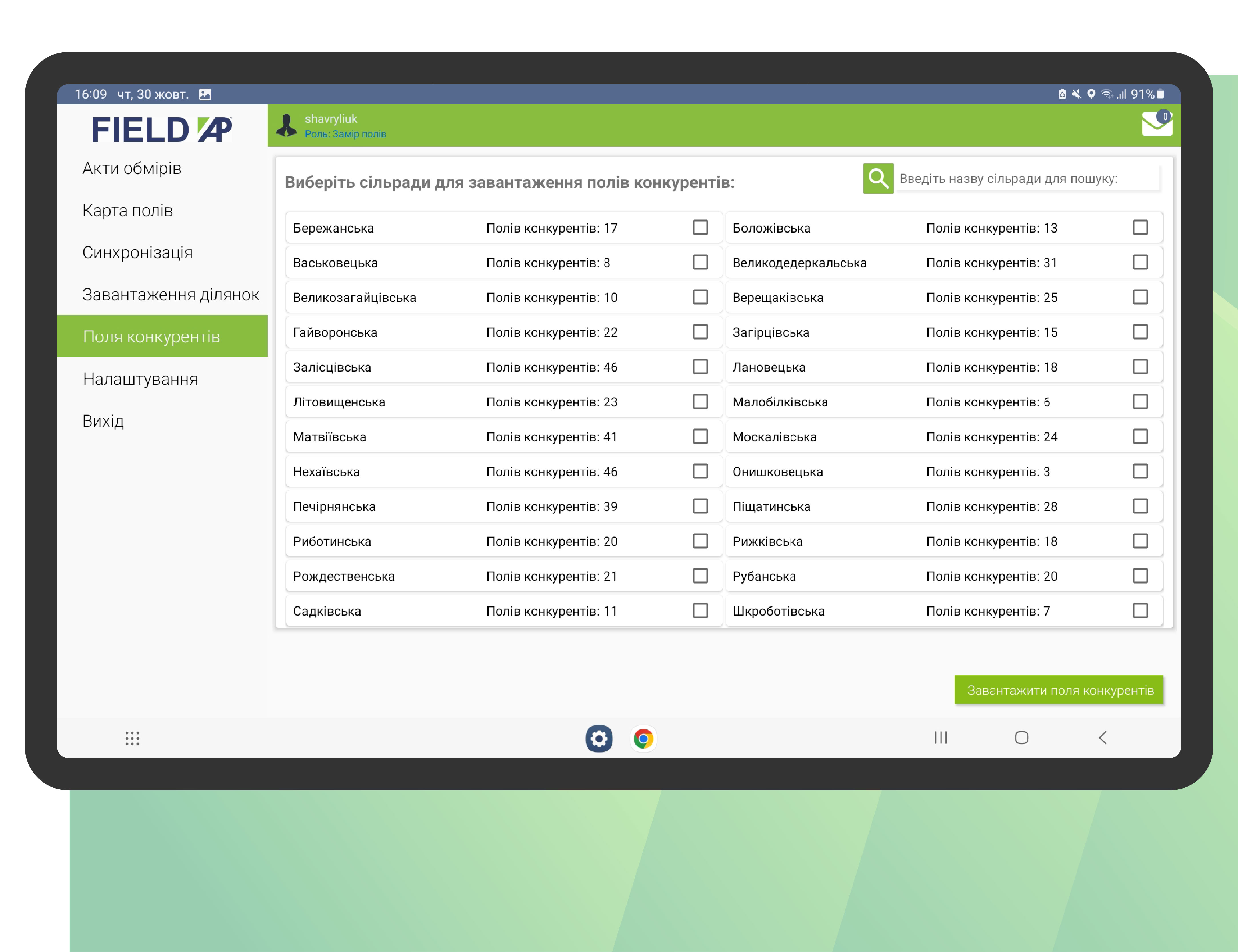
Loading competitors' sites
Competitor polygon loading function
For consultation regarding the use of AP Fields
contact us or leave your contact details